FMCommander™ Internet Map Synchronization Option
Automatically tie in to Google Earth™, Google Maps™, Bing™ Maps, TopoView™, TopoZone™, Tagis Maps™, Acme Mapper™ and the USGS Map Store websites.
FMCommander’s Internet Mapping Option
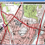
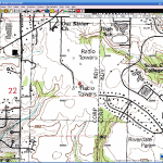
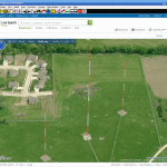
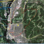
V-Soft designers have increased internet mapping functionality in FMCommander thanks to a new browser integration with Google Earth and other Internet mapping sites. The internet map sites are integrated with the selected station coordinates, so with just the click of your mouse on the desired station you can view the transmitter site on a topographic map or on an aerial and satellite photo. When used with Google Earth™ you can place your station’s FCC contour over the Google Earth™ map and you can add multiple contours of the same station or others for coverage comparison purposes. You can also plot a complete, minimum separations based, “area-to-located” map. Both Google Earth™ and Bing Maps™ provide road and aerial views and in most places, a four-sided directional “Birdseye” view of requested sites. Below are some examples of the features using the Acme Mapper™ for topographic maps, Bing Maps™ for satellite birds eye tower views and Google Earth™ to show area-to-locate and coverage maps. Click the thumbnails to enlarge the images.
(Each of these Internet mapping sites has its own licensing.)
With this option you can:
Click on the “globe” icon on the “Find Information Screen” to automatically connect to the Internet map servers. For example, let us say you are looking at an FMCommander coverage map of a station in San Francisco and you want to see it from the air looking down.
Click the “globe” icon, shown above, and the program brings up the satellite map showing the transmitter site. (The servers we use are free for public use, but depending on how they are used, some sites may require licensing.) Maps can be loaded from most all of FMCommander’s mapping and and utility windows. The topographic map below, shows the Twin Peaks transmitter location of KALW when using Acme Maps™.
Synchronizing with Google Earth
The Internet Mapping Option also allows the user to view any transmitter location from the list on the “Find Information Screen” through Google Earth™. This is very handy for finding the actual ground elevation that are quite accurate. Zooming out will show you the coverage contour of the station within Google Earth™ that you have selected. From the “Function” menu simply select “Google Earth” and the computer takes care of the rest. When on the “Separations Mapping Screen”, you can plot the separations circles over a Google Satellite Map.
The graphic below shows the Google Earth™ view of the transmitter site of the station under current selection from the “Find Information Screen.” Using Google Earth™ requires installing the Google Earth™ program available for free from Google.
 The Google Earth™ controls can be used to zoom further in on the site or to give the site a different 3-D view.
The Internet Mapping Option’s minimal price is well worth the increase in work productivity that can be obtained from integrating it with FMCommander.
Contact V-Soft Communications to learn more about the new Internet Mapping Option available for FMCommander users.
Click here to browse up to the FMCommander main web page.


