Our I.D. series of programs are developed as Windows native programs. The series performs a search of the U.S. Transportation Department’s Airport Database, the FCC’s Tower and NOAA Obstruction databases, the US Census population databases, the USGS’s database of 32,000 cities, and the AM, FM and TV databases of the FCC.
IDTowers™
Identify the location and ownership of towers within the prescribed distance from your study coordinates using ID Tower. This program incorporates both the FCC’s Antenna Survey database and the NOAA obstruction database. Simply enter your search coordinates, choose the tower heights you wish to identify and click “OK” for an instantaneous list, sort ordered by the closest first. Next, when using the FCC’s Antenna Survey database, if you double click a tower’s listing it will give the records owner and address. The use of both the FCC and NOAA database allows you to determine if differences exists between the listings and to identify towers not found in one listing or the other. A new feature recently added to this database allows direct linkage to our new fully detailed tower registration database through our program VTower.
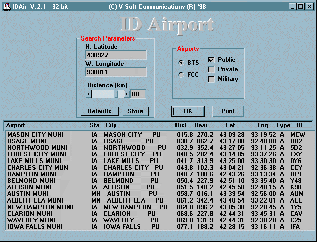
 IDAirport™
This program searches for your choice of public, private and/or military airports within a prescribed search distance from your selected coordinates. The closest airport is listed first along with its distance and true North bearing. This is followed by the airport name and city, airport I.D. and type as well as transportation department listed coordinates. You can send the results to a printer simply by clicking the “print” button.
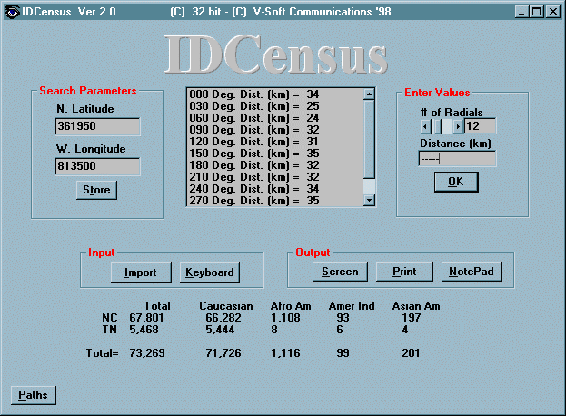
 IDCensus™
Find the population within any set of distances to signal contour points. You type in in the coordinates and the distances to key signal contour points and within seconds after you click the “OK” button, the program will calculate the number of people within the signal contour and print the results. The totals will be ordered by state with a racial breakdown provided. The results can be easily sent to a printer. Distance to contour files can be imported from ASCII files or from other V-Soft applications.
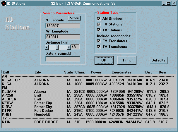
 IDStations™
This is one of our newest programs which incorporates all three FCC databases, the AM, FM and TV, into one handy identification program. As in the other ID series programs, simply type in the central coordinates from which to begin the search and the program identifies all stations within your search distance parameters. It then sort orders the stations to your screen listing the closest first. You may filter out FM or TV translators if you wish. The program lists the stations, their call letters, frequency and class, location, power and FCC listed coordinates. Using the optionally provided V-Soft extended search databases, you can bring up the complete FCC record simply by double clicking the listing with your mouse.
 IDCities™
Identify the coordinates of up to 32,000 US cities from the U.S.G.S. extensive database of cities. Just type in a few letters of the city and the computer will find the city’s coordinates.You can also progress alphabetically through the list by clicking “Next”.

